
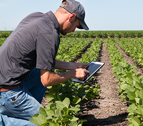
The Right Tools for the Job
We carry the most advanced precision agriculture technology on the market from trusted brands like Trimble. Our products increase farm efficiency and in turn, boost return on investment. Whether you are looking for options for machine control, guidance for spray and application control, assistance with water use or a better way to monitor your yield, we offer the best combination of technology-based solutions for your farm operations.
- Data Management
- Displays
- Fleet Solutions
- Flow & Application Control
- Irrigation/Water Management
- Planting
- Steering Systems
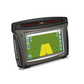
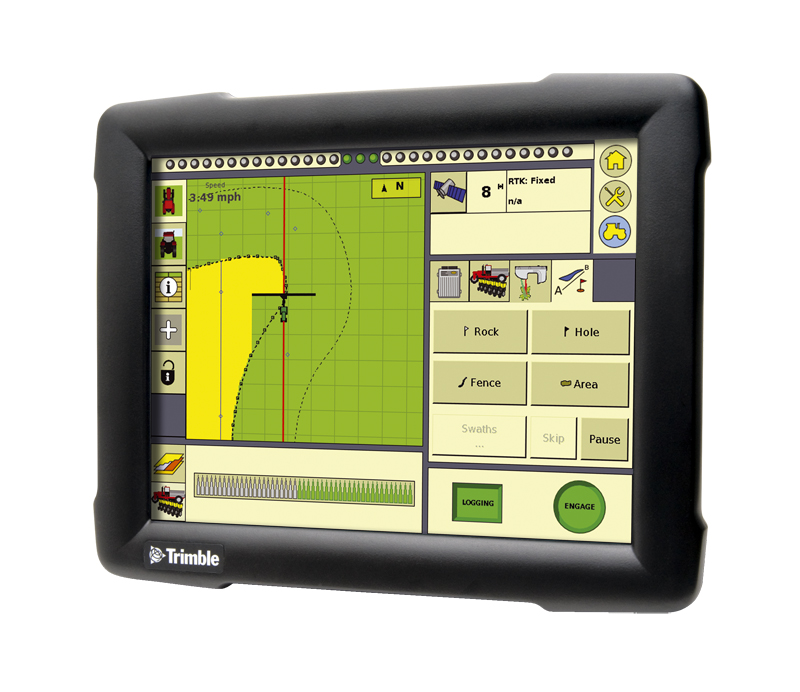
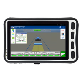
The CFX-750™ display is an affordable, multi-function guidance display offering key precision agriculture capabilities.
CFX-750
Key Features
- Rugged construction for everyday field use
- Mid-sized 8.0” color touchscreen
- Intuitive user-interface
- One built-in, dual-frequency GPS receiver
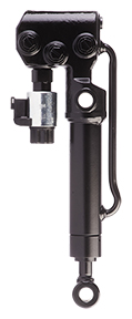
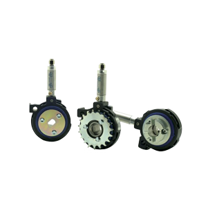
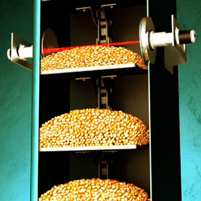
Each row has unique depth control. From flat fields, to varied terrain, and across soil types.
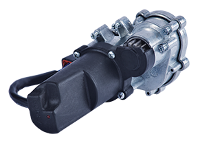
DeltaForce is a unique solution to down force that has features and performance no one else offers. When you control down force, you avoid shallow-planted seeds and you avoid root compaction. Simply put, you increase your yield.
DeltaForce by Precision Planting

The Trimble® EZ-Guide® 250 system is an entry-level display providing high-quality guidance capabilities at an entry-level price.
EZ-Guide 250
Key Features
- Rugged construction for everyday field use
- Compact 4.3” color screen
- Quick installation and fast learning curve
- One built-in GPS receiver
We will help you make a plan based on your specific needs and get you started in collecting and organizing your data.
Getting Started with Data Management
Begin putting your data to work for you.
- Generate basic reports to begin crop record keeping
- Map your field boundaries
- Input and view scouting reports
The RainWave® precipitation monitoring solution provides you with vital rainfall data, allowing you to make better management decisions for irrigation planning, vehicle deployment, and timing of material application for nutrient and pest management.
RainWave
Key Features
- Reduce trips to the field
- Eliminate rain gauge reading errors and maintenance
- Make informed decisions on resource deployment
- Understand how much water ran off the field and how much was absorbed into the soil based on intensity reporting
Add layers to your data such as fleet management, field mapping, accounting and mobile apps, putting your data at your fingertips.
Intermediate Data Management
Vantage Southeast can take you to the next step when you're ready to begin bringing your data together by integrating more features such as:
- Desktop software for mapping, importing/exporting precision farming data, field records and simple cash accounting.
- Mobile app software: For in field data acquisition you can use your mobile phone or other mobile devices.
- Basic Accounting Reports (Input costs/acre and hour available in intermediate and premium accounts)
- Financial statements available with proper data entry including budget, general ledger, depreciation report, enterprise statements, etc.
- Enter multiple crop plans for a field, then compare crop plans side-by-side to choose the best course of action.
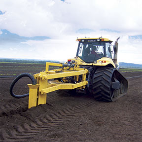
The Trimble® FieldLevel™ II system streamlines the surveying, designing, and leveling steps required for land leveling projects. FieldLevel II helps ensure optimal water management by providing improvements in yields, water usage, and farm productivity.
FieldLevel II
Key Features
- Efficiently distribute water by maintaining grade
- Improve yields by controlling excess water
- Minimize water costs and improve farm productivity

Seriously impact the growth, accuracy and predictability of your operation with the professionals at Vantage Southeast
Full Integration Data Managment
Begin to seriously impact the growth, accuracy and predictability of your operation when the professionals at Vantage Southeast set up your entire operation online. The end goal is to be able to click on any field and understand all operations and costs for any given growing season. To get to this point, these are some of the features that can be added:
-
Add information such as machine and implement fleet, input prescriptions, rental and purchase information, crop information, annual yields
-
Wireless data transfers between the office and Trimble displays
-
Custom dashboard layout for weather, commodity cash bids and futures prices and more.
-
Share your information with your trusted farm advisors
-
Add maps such as irrigation, soil sample, irrigation and yields
-
Irrigation Controls: Monitor and Control, Section Control up to Full VRI Controls on your Pivot, Reporting
-
Soil Sampling, Fertility Management and Prescription Applications - VRA
-
Weather Monitoring and Record Keeping
-
Task Application Recording from In Field Devices on Machines. For example, the planter in the field running a Trimble display will collect the seed variety, amount of seed and cost per asset. You begin to know true costs per acre per application, including cost for the tractor, planter, seed and any other inputs.
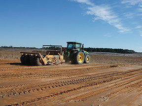
The WM-Drain solution ensure optimal 3D drain placement, which improves crop yields by controlling ponding, optimizing root depth, maximizing planting seasons, and minimizing nutrient loss.
WM-Drain Farm Drainage Solution
Key Features
- Seamless, integrated solution for survey, analysis, design, installation, and mapping steps of surface and subsurface drainage projects
- Surface software for analysis and optimal 3D drainage design
- On-the-go design capabilities
- T3™ Enhanced Terrain Compensation Technology for roll-corrected 3D positioning
- Wireless data transfer between the farm office, vehicles, and workers in the field
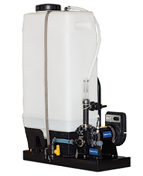
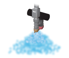
The Sidekick Pro™ direct injection system offers greater accuracy and savings with every pass
Raven Sidekick Pro
The industry leader in direct injection, Sidekick Pro features:
- High resolution encoder that provides smoother pump control and exceptional lock on target rate technology
- Remote closed-system calibration, eliminating the need for calibration catch tests and exposure to chemicals
- Compatibility with additives that reduce maintenance on your application system
- Low volume capacity of 1-40 ounces per minute
- High volume capacity of 5-200 ounces per minute
- Automatic priming feature
- Real-time diagnostics
- ISO compatible pump
RINSE ASSIST FOR DIRECT INJECTION
- Automatic rinse system that can clean the chemical out with the push of a button
- Three way valve automatically opens to a rinsing agent tank
- Valve automatically returns to chemical tank position at the end of the rinsing cycle
With the Sidekick Pro™ direct injection system, you can save more in time and inputs—and get more for it when applying costly herbicides, insecticides, liquid fertilizer and nitrogen stabilizer. And because there’s no pre-mixing in the tank, there’s no waste from unused product—and no cleanout/disposal issues when you’re done. Watch this video to learn more about how it works!
The Trimble® WM-Topo™ survey system is a topographic data collection device that can be taken into hard-to-reach areas such as ditches, steep terrain, muddy fields, or fields with mature crop cover. Survey data can be used to create surface models-to help you make well-informed water management decisions.
WM-Topo Survey System
Key Features
- Internal radio available with either 900 MHz or 450 MHz frequency options
- Ultra-rugged housing built to withstand harsh conditions
- 440 channel GPS and GLONASS receiver
- GNSS receiver, antenna, battery, and radio in one unit
- Bluetooth® connections enable wireless communication between GNSS receiver and Yuma® 2 or Nomad® handheld computers
- USB host connection for memory stick
Precision like you've never seen before
Raven Hawkeye Nozzle Control System
Base Package Features
- Nozzle-by-nozzle turn compensation minimizes over and under applications
- PWM (Pulse Width Modulated) valves give you:
- Improved pressure consistency and reaction time across the boom, regardless of the flow rate or ground speed
- Turn compensation
- Fewer nozzle changes - Individual valve diagnostics monitor each nozzle
- Up to 16 virtual sections providing more section control and higher ROI than traditional shut-off systems
Ease of Use
- Fully integrated with machine application control systems
- Simple installation, setup, and calibration
- Fully integrated system means one display in the cab
- Preset pressure settings allow for quick adjustments on the fly
- Single ECU controls rate, pressure and section shutoff, providing:
- The ability to switch between Hawkeye and conventional mode
- Mapping and data logging of each nozzle for more accurate mapping and record-keeping
Bonus Features
- Seal maintenance kit included with each system
- Two-year warranty with registration at www.ravenhelp.com
- ISOBUS compatible
Hawkeye HD
- Provides individual nozzle on/off with a simple software unlock, no change in hardware required
- Reduces costly skips or overlaps
- Individual nozzle shut-off
Virtual Section Capability
- Program up to 16 additional sections for on/off control
- Available with base system–no upgrade needed
- Provides more section control and higher ROI than traditional boom valve configured systems
Sidekick Pro™ Direct Injection Compatibility
- Inject additional chemicals in the line as needed without worrying about tank mixing or clean-out at the end of the day
- Greater flexibility in your applications, so you can handle weed resistance and other challenges
- With Hawkeye, use up to 5 injection systems on one machine through the Viper® 4+.
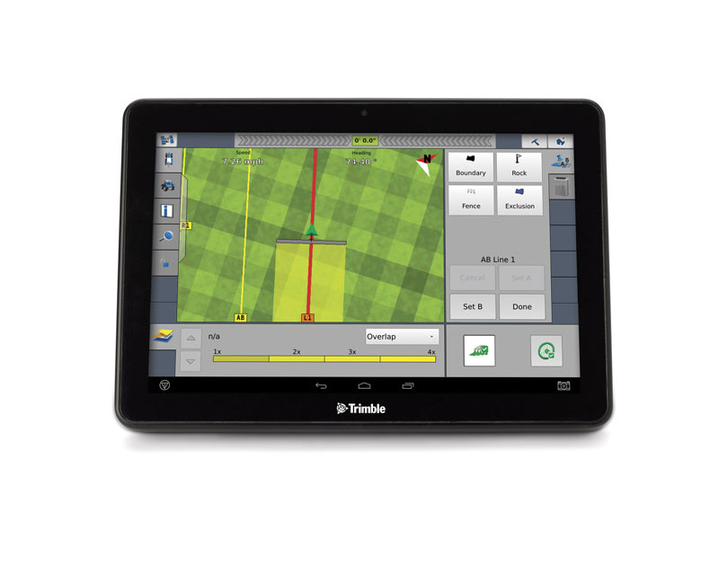
The Trimble® FmX® integrated display is an advanced, full-featured guidance display for all your precision farming applications.
FmX Integrated Display
Key Features
- Rugged construction for everyday field use
- Large 12.1” color touchscreen
- Intuitive user-interface
- On-screen guidance LEDs
- Four video camera inputs
- Two built-in GPS receivers
- GLONASS ready
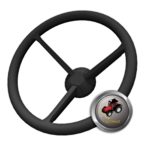
An automated steering system that steers your vehicle on line with maximum precision. When your vehicle gets offline, Autopilot signals it to adjust its position to follow the correct path, no matter the field pattern or terrain type—so you can focus on the job ahead of you.
Autopilot
Key Features
- Integrates directly into your vehicle's hydraulics for clear access to cab control
- Ideal for the most demanding row crop farming applications
- Plugs in to many guidance-ready vehicles, minimizing the need for additional equipment

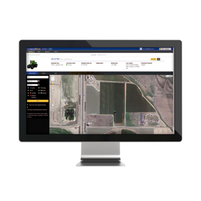
Trimble GeoManager Fleet Management enables fleet managers to make intelligent decisions using real-time field status information.
Fleet Management
Fleet Management offers a range of on-demand information and activity reports on key data such as vehicle location, condition and mileage. In addition, Fleet Management includes exception alerts which highlight issues such as when a vehicle hasn’t moved or leaves its designated work area. With this visibility in to fleet operations, businesses can manage fleet performance and costs, running the most efficient fleet possible.
Key Features
- View the real-time status and locations of your vehicles and field technicians
- Exception alerting - Includes speeding, idle time, landmark entry/exit, stop count and duration, distance driven, off-hours use
- Vehicle diagnostics - offering real-time and retrospective reporting on fuel, carbon, odometer and fault codes
- Configurable Reporting - on demand or scheduled
- Scheduled notifications for vehicle maintenance
- Data integration to other existing business solutions
- Direct communications to drivers including messaging and mobile forms
Key Benefits
- Increase fleet productivity using real-time location intelligence.
- Decrease fuel costs by reducing unauthorized vehicle use, curbing excessive speeding and lowering idling.
- Manage maintenance schedules which reduce vehicle wear and tear, lowering the risk of mechanical failure.
- Identify activity that causes excessive carbon emissions such as speeding, excessive idling and route deviation.
- Improve fuel economy and reduce repair costs through proactive engine monitoring and maintenance.
The Trimble® TMX-2050™ display lets you work smarter. Take control of your entire operation with a system that gives you the control, clarity, certainty and connectivity you need.
TMX-2050 Display
Key Features
- Rugged construction for everyday field use
- Large 12.1” (30.8 cm) high-definition color touchscreen
- Android-based operating system
- One integrated GNSS receiver
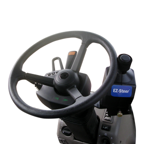
An assisted steering system that provides high-accuracy steering at an affordable price. When you are driving your vehicle, the EZ-Pilot system turns the wheel for you with a compact electric motor drive using guidance from Trimble displays to help keep you on line and improve your efficiency.
EZ-Pilot Steering System
Key Features
- Complete field applications quickly and accurately
- Reduce operator fatigue and increase safety
- Operate day or night and in dusty or low visibility conditions
- Terrain Compensation Technology
- EZ-Pilot uses T3™ sensors to calculate the actual position of the vehicle to help minimize skips and overlaps in areas with rolling terrain, slopes, and rough ground.

The Easy Road to Compliance
Trimble Fieldmaster Logs
Managing an organization that operates a fleet of vehicles can mean complying with strict Department of Transportation (DOT) Hours of Service (HOS) regulations. The DVIR tool quickly walks drivers through a checklist before taking the vehicle on the road to ensure tires, brakes, mirrors and other vehicle parts are functioning properly.
Features
- Real-time electronic record keeping of HOS/DVIR activities
- Support for FMCSA 395.15 standards for monitoring
- Hours of Service
- Support for FMCSA 396.11 standards for driver vehicle inspection record keeping
- Automatic calculation of driver availability based on assigned rules
- Easy access to driver's’ duty status and driving history
- Record storage in compliance with FMCSA requirements
- Driver alerts to warn of possible violations
- Advanced DVIR capability to confirm vehicle inspections
Benefits
- Reduce errors by automating entry of duty time
- Improves operations with increased back office visibility
- Increases productivity by eliminating time-consuming manual logs
- Increases profitability by mitigating non-compliance fines and penalties
- Reduces audits with on-demand driving data and 6 months of archived reports
- Increases accuracy with electronic filing
- Accelerates and simplifies inspection for compliance officials
- Provides peace of mind knowing compliance regulations have been met
- Delivers best-in-class user experience for logging hours of service
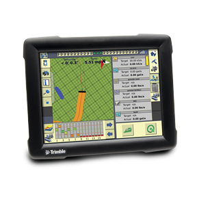
A crop input control system enables productive and efficient functionality for your planting and nutrient and pest management operations.
Field-IQ system
Key Features
- Variable rate application control
- Automatic section control
- Boom height control
- Seed monitoring
- Spinner speed control
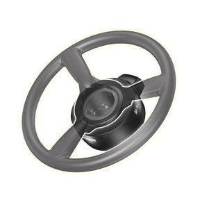
The Trimble® EZ-Steer® assisted steering system provides simple, portable, hands-free farming for more than 1200 vehicle models - old and new. The EZ-Steer system turns the steering wheel for you by combining a friction wheel and a motor with guidance from any Trimble display.
EZ-Steer Steering System
Key Features
- Provides hands-free guidance for your many farm vehicle types
- Allows for unrestricted manual steering when assisted steering is not engaged
- Utilizes terrain compensation technology for high accuracy on difficult terrain
- Easy installation and transferability from vehicle to vehicle
- Compatible with any Trimble® display
- Ideal for broadacre farming applications where extremely accurate positions are not required
Track asset location,speed, stop time and utilization time
Trimble Asset Tracking
Trimble Asset Tracking offers a range of on-demand information and detailed activity reports on key data such as asset location,speed, stop time and utilization time. It also reports on disconnect events, alerting users if a unit has been disconnected from its main power supply, has been stolen or is being used at an unauthorized time.
With the visibility in to where towed assets are and how they are being used, businesses can better manage asset performance and costs to run the most efficient field operation possible.
Features:
- Live Map - View the real-time status and locations of your towed, powered and non-powered Assets
- Integrated - Integrates with Trimble Fleet Management to view your vehicles and assets within one interface
- Utilization Reports - Enables you to generate high level utilization reports for an individual or group of assets within one interface
- Rugged Device - Features a rugged design and construction to be used outside for multiple assets (i.e. refrigerated trailer, generator, pump)
- Long Life Battery - Offers sophisticated, long life and rechargeable battery that can emit location alerts for up to 3 months on a single charge
- Real-time Alerts - Sends a real-time alert if a unit changes location or has been disconnected and offers wakes on motion for instant location reporting
- Allows you to view the location and status of your towed, powered and non-powered assets. (5 minute updates when towed. Once per day when stationary)
- Integrates with Trimble Fleet Management to view your vehicles and assets within one interface
- Enables you to generate high level utilization reports for an individual or group of assets across multiple locations
- Features a rugged design and construction to be used outside for multiple powered and non-powered assets (refrigerated trailer, generator, pump)
- Offers sophisticated, long life and rechargeable battery that can emit location alerts for up to 3 months on a single charge
- Sends a real-time alert if a unit changes location or has been disconnected
- Wakes on motion for instant location reporting
Benefits
- Enables complete convenience with visibility in to asset usage and location in one place from an online portal
- Offers simple deployment with anytime, anywhere access
- Allows vehicle fleet location to be viewed alongside assets for more effective assignment
- Ensures maximum utilization of assets by monitoring productivity rates
- Improves optimization by identifying idle and rarely used trailers to reallocate
- Allows stolen assets to be located or unauthorized use to be identified through real-time alerts
- Provides dependable, rugged hardware with quick and easy self-installation and de-installation
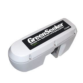
A crop sensing system that helps you effectively and precisely manage crop inputs on-the-go by applying the right amount of fertlizer, in the right place, at the right time.
GreenSeeker system
Key Features
- Provides instant sidedress fertilizer application for inputs such as nitrogen
- Uses optical sensors to measure and quantify crop health—or vigor
- Compatible with both the TMX-2050™ display and FmX® integrated display
- Works with most variable rate controllers and delivery systems
- Can be mounted on booms on most sprayers/spreaders
Keep your implement and tractor on the same guidance line with the Trimble® TrueTracker™ implement steering system, an active implement guidance system that allows your implement to guide itself independently from your tractor.
TrueTracker System
- Allows the implement to correct its position without input from the tractor
- Utilizes terrain compensation technology for high accuracy on difficult terrain
- Requires a GNSS antenna and NavController II on your implement, Autopilot™ system, and the FmX® display in your tractor
- Ideal for row crop and multiple-pass farming applications
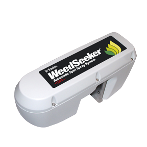
A spot spray system is an effective solution to help you efficiently control weeds by sensing if a weed is present and delivering a precise amount of chemical - spraying only the weed and not the bare ground.
WeedSeeker System
Key Features
- Uses advanced optics to sense if a weed is present
- Applies chemicals directly on the weed
- Utilizes standard pumps, tanks, and plumbing so an existing spray boom can be retrofitted
Control your implement with the Trimble® TrueGuide® implement guidance system, a passive guidance system that monitors and corrects the position of your implement with compensation from your tractor.
TrueGuide System
Key Features
- Allows the implement get on line with movement from the tractor
- Requires a GNSS antenna on your implement and Autopilot™ system and the FmX® display in your tractor
- Ideal for broadacre crop applications in which multi-pass repeatability is not required
Tru Count Air Clutches and LiquiBlock valves deliver superior performance for all your planting and spraying applications. They allow you to start and stop the flow of seed and fertilizer in real-time from the vehicle cab.
TruCount Products
Key Features
- The Tru Count Air Clutch® eliminates seed overlap in your headlands and point rows
- Tru Count LiquiBlock™ valves eliminate liquid fertilizer overlap
- Compatible with the TMX-2050™, FmX®, and CFX-750™ displays and a variety of other guidance displays
The Trimble® MMX-070 display is a robust, portable, Android™ tablet built for agriculture. It combines the capabilities of a precision farming display with the advantages of a tablet.
MMX-070 Display
Key Features
- Compact 7” color touchscreen
- Android™ platform ready for future development
- Built-in WiFi and Bluetooth
- Easily transfers between vehicles and outside the cab for mapping and scouting tasks
Track your fleet locations and manage valuable information from the office or any location with internet access. Managers are able to transform their fleet performance by viewing time spent idling, moving, and traveling as well as delay reasons.
Fleet Manager
Key Features
- Decrease fuel costs by reducing unauthorized vehicle use.
- Identify activity that causes excessive carbon emissions such as speeding, excessive idling, and route deviation
- Reduce repair costs through proactive engine monitoring and maintenance
- Increase operator performance by monitoring productivity and delays

With the Trimble® RG-100 row guidance system, you can automatically adjust the combine in response to changes in the rows by using existing sensors built in to the combine head.
RG-100 Row Guidance
Key Features
- Uses existing row guidance sensors to sense the position of the combine
- Works with the Autopilot™ system to automatically steer your combine along rows
- Utilizes terrain compensation technology on the Autopilot system for high-accuracy steering in rolling hills, slopes, and rough terrain
During harvest, you can accurately view, map, and record crop yield and moisture data in real-time to instantly understand how well your crop performed
Yield Monitoring
Key Features
- Decrease fuel costs by reducing unauthorized vehicle use, curbing excessive speeding and lowering idling
- Easily identify activity that causes excessive carbon emissions
- Reduce repair costs through proactive engine monitoring and maintenance
- Increase operator performance by monitoring productivity and delays
Higher accuracy. Higher yield.
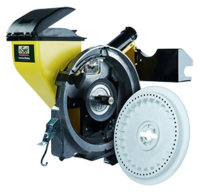
Get higher accuracy and higher yield to make constant meter tweaks a thing of the past. Improved singulation and better flexibility are in your grasp. vSet brings a relentless singulator that has five floating steel lobes to ensure one seed per hole, with all kinds of seeds. And with a flat disk, you get consistent seed release, every time.
vSet by Precision Planting
The PurePixel™ precision vegetation health solution provides farmers and their trusted advisors with a high source of vegetation health information to drive improved crop analysis.
PurePixel
Key Features
- Saves time by targeting specific locations for crop scouting versus scouting the entire field
- Reduces economic losses by providing an early warning system for crop health
- Improves management decisions by comparing PurePixel maps to other field operations maps such as as-applied fertilizer, as-applied seed, and yield maps
- Identify differences in crop health and maturity even when crop health is generally strong
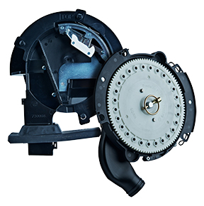
vDrive is a custom planter on each row. Whatever you need and ask of that row happens. Period.
Season one, you have the capabilities to do your best planting, plus a meter and drive setup that has staying power for the seasons ahead.
vDrive by Precision Planting
Trimble Agriculture offers farm software solutions for data analysis—including mapping, accounting, water management, and more for comprehensive management of your farm.
Farm Works
Key Features
- Print a variety of maps and field record reports
- Create, edit, and manage guidance paths
- Design basic and advanced prescription maps
- Analyze profit maps to verify which parts of the fields are more profitable
- Compatible with a wide range of precision farming displays.
eSet by Precision Planting
Every seed. Every time.
The new standard for seeding accuracy and flexibility, you can space precisely and harvest more by dropping a single seed down the center, every time. It's simple ingenuity that other meters just don't have. Plus, you can handle any seed size or shape without adjustment.
eSet by Precision Planting
Vantage is a trademark of Trimble Navigation Limited. All rights reserved.